Public Outreach Session 1 – Port of Fort Pierce Master Plan
Public Outreach Session 1 – Port of Fort Pierce Master Plan
Events
Port of Fort Pierce Master Plan - Virtual Webcast - Session 2
Thanks for your interest! Registration is closed because the event has concluded.
Step 1
HOW SHOULD THE PORT EVOLVE TO EMBRACE COMMUNITY ECONOMIC AND SOCIAL OPPORTUNITIES?
This is the central question posed by St. Lucie County and its consultants as we embark on the update of the Port of Fort Pierce Master Plan. Join us in this important conversation about the future of your Port!
OUR PUBLIC ENGAGEMENT PORTAL IS NOW OPEN!
Thank you to the 250 participants taking part in our 3 virtual webcasts between July 1 and 2! If you were not able to participate, each webcast was recorded and available for viewing at the end of this webpage. The base content and presentation was the same for each meeting; audience comments varied.
There are several other ways to take part and stay involved in this important planning effort - all are provided below! Sign up for all project news and announcements. Take our survey on community priorities for the Port. Review project presentations and materials in our downloads section. Return to this website for the latest information and news.
GET IN TOUCH WITH THE PROJECT TEAM!
If you have any questions or comments that you would like addressed by St. Lucie County, please email Kori Benton: bentonk@stlucieco.org
ABOUT THE PROJECT
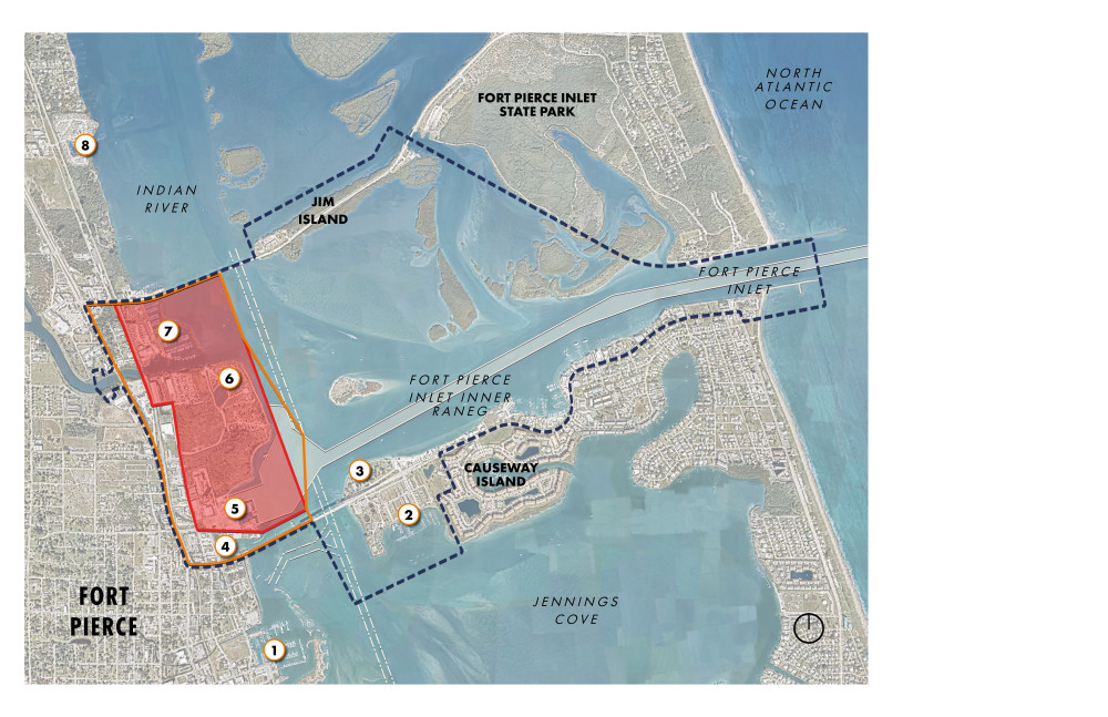
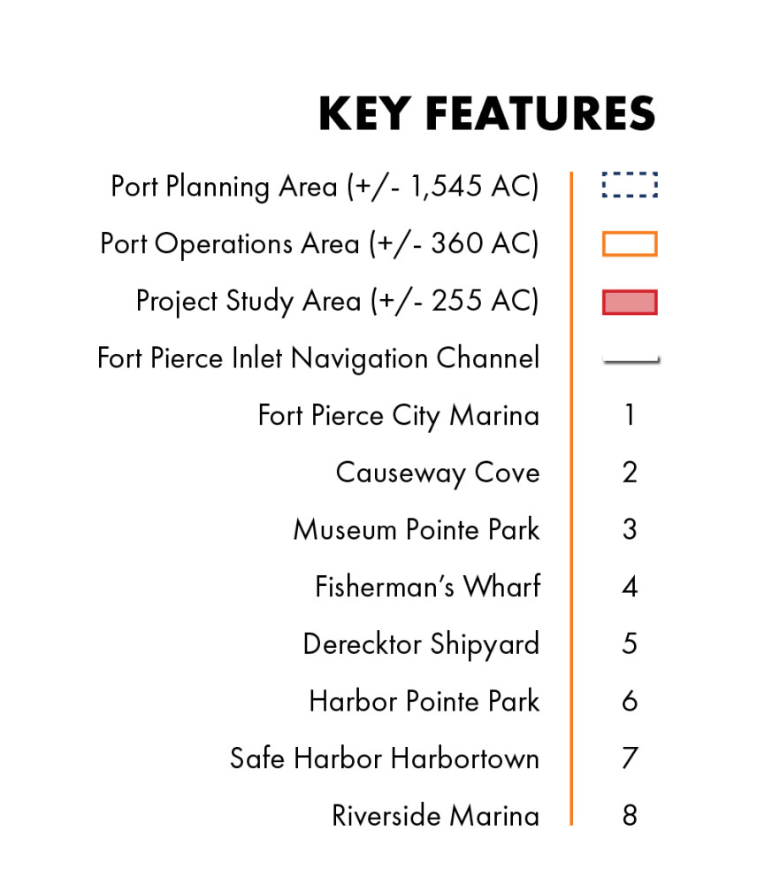
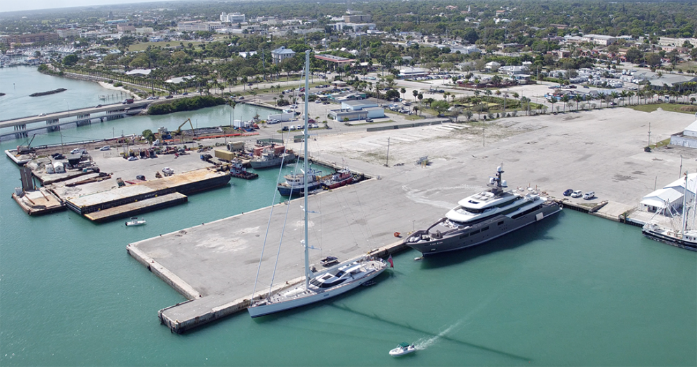
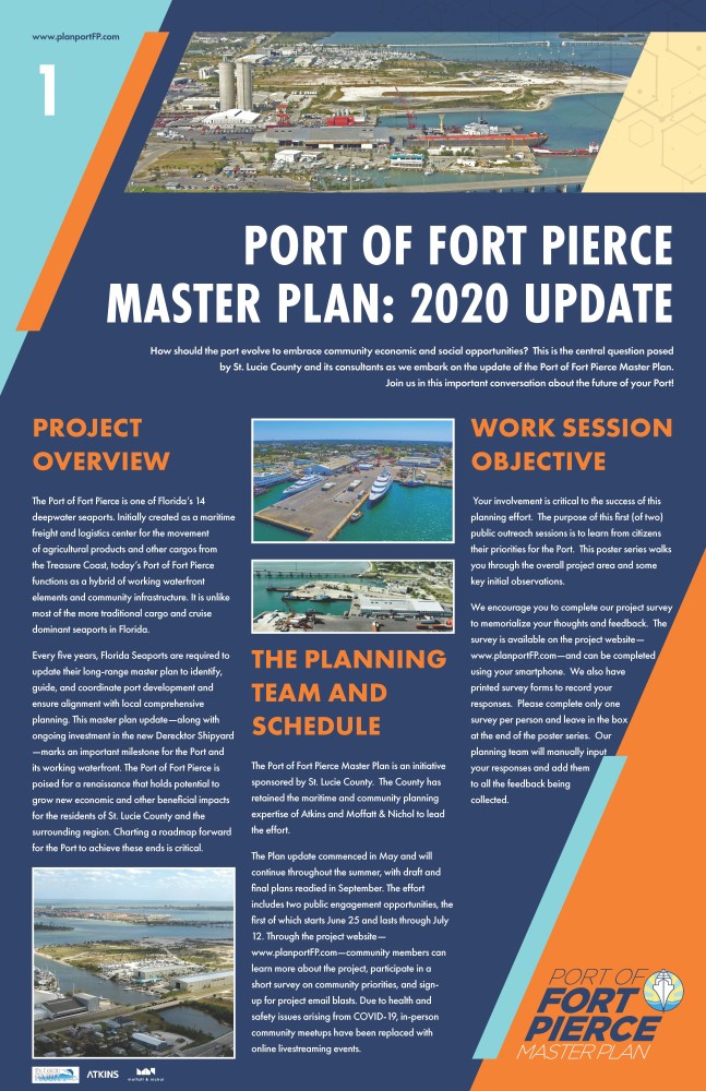
The Port of Fort Pierce is one of Florida’s 15 deepwater seaports. Initially created as a maritime freight and logistics center for the movement of agricultural products and other cargos from the Treasure Coast, today’s Port of Fort Pierce functions as a hybrid of working waterfront elements and community infrastructure. It is unlike most of the more traditional cargo and cruise dominant seaports in Florida.
Every five years, Florida Seaports are required to update their long-range master plan to identify, guide, and coordinate port development and ensure alignment with local comprehensive planning. This master plan update—along with ongoing investment in the new Derecktor Shipyard—marks an important milestone for the Port and its working waterfront. The Port of Fort Pierce is poised for a renaissance that holds potential to grow new economic and other beneficial impacts for the residents of St. Lucie County and the surrounding region. Charting a roadmap forward for the Port to achieve these ends is critical.
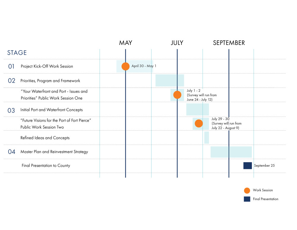
The Plan update commenced in May and will continue throughout the summer, with draft and final plans readied in September. The effort includes two public engagement opportunities, the first of which starts June 25 and lasts through July 12. Through the project website, community members can learn more about the project, participate in a short survey on community priorities, and sign-up for project email blasts. Due to health and safety issues arising from COVID-19, in-person community meetups have been replaced with online livestreaming events.
SUBSCRIBE AND RECEIVE THE LATEST PROJECT NEWS
TAKE OUR SURVEY ON COMMUNITY PREFERENCES
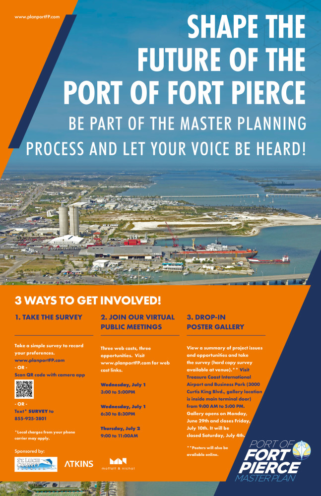
STOP BY OUR POSTER GALLERY
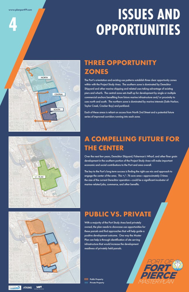
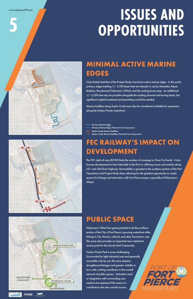
Prefer tactile posters and printed surveys? Then our drop-in poster gallery summarizing the project is perfect for you. Our poster series summarizes the overall purpose of the plan, the planning process and its respective milestones, key issues and opportunities, and other data. There will be hard copies of the online survey available for completion and deposit in a review box, with these surveys manually entered into the database and added to all online public feedback.
The gallery is just inside the door of the main terminal at the Treasure Coast International Airport and Business Park located at 3000 Curtis King Blvd. Parking is free and plentiful! Call (772) 462-6766 for more information and directions. Hours of operation are 9:00 AM to 5:00 PM, Monday through Friday. The exhibit will be open for viewing until July 10. It will be closed Saturday, July 4th. Posters will be made available through our download link at the end of this webpage.
THE PROCESS FORWARD
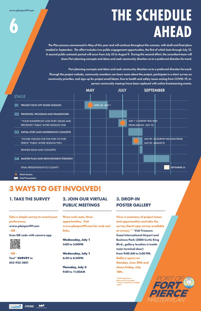
The Plan process commenced in May of this year and will continue throughout the summer, with draft and final plans readied in September. The effort includes two public engagement opportunities, the first of which lasts through July 12. A second public outreach period will occur from July 22 to August 9. During this second effort, the consultant team will share Port planning concepts and ideas and seek communty direction as to a preferred direction forward.
Through the project website, community members can learn more about the project, participate in a short survey on community priorities, and sign-up for project email blasts. Due to health and safety issues arising from COVID-19, in-person community meetups have been replaced with online livestreaming events.
AVAILABLE PRESENTATIONS AND DOWNLOADS
Please find below links to master plan posters, presentation, and webcasts. We will continue to add to this archive as materials are prepared, refined, and released.
REVIEW OUR VIRTUAL WEBCASTS!
The COVID-19 Pandemic prevented us from holding in-person meetings and open house sessions. Instead, the consultant team held 3 web-based livestreaming events to allow you to learn more about the project, exchange ideas, and ask questions. These webcasts were held on the following dates / times:
- Session 1 – July 1st from 3:00 to 5:00 PM
- Session 2 – July 1st from 6:30 to 8:30 PM
- Session 3 – July 2nd from 9:00 to 11:00 AM
Each webcast included the same general content and was recorded for sharing/viewing below.
Port of Fort Pierce Master Plan - Virtual Webcast - Session 3
Thanks for your interest! Registration is closed because the event has concluded.
Port of Fort Pierce Master Plan - Virtual Webcast - Session 1
Thanks for your interest! Registration is closed because the event has concluded.