 Update on the Green to Cedar Rivers Trail - South Segment
Update on the Green to Cedar Rivers Trail - South Segment
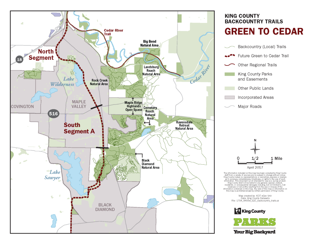
King County Parks is proposing to develop a 2-mile-long section of the Green to Cedar Rivers Trail (G2C Trail) to connect SE Kent-Kangley Road to the Black Diamond Open Space. This project is part of a larger vision to improve mobility and access to high-quality regional trails for people of all ages and abilities to enjoy.
Please read each section below and answer the survey questions by January 20, 2023. This survey will take approximately five minutes to complete.
2017 – Preliminary design and outreach: The voter-approved 2014-2019 Parks, Trails, and Open Space Replacement levy package included funding for the design and paving of the north segment and preliminary design of the south segment of the trail. King County Parks gathered feedback on the design plans for the north segment. KCP heard that connecting the trail to the Black Diamond Open Space was more important to the community than developing the north segment.
2018 – Additional community engagement, project on pause: King County Parks continued additional community outreach and design work for the complete corridor. However, improvements to the 3.3-mile-long north segment were delayed due to the increased costs of building trails.
2019 – Shifted focus to South Segment A: Based on feedback, King County Parks shifted focus to propose improvements to the two-mile-long gravel trail from SE Kent-Kangley Road to the Black Diamond Open Space Natural Area (South Segment A). This would then create a consistent-width trail with safe road crossings that would connect the north segment to the 1,240-acre Black Diamond Open Space. King County Parks proposes to utilize the funds allocated for the north segment to instead develop South Segment A.
2020 – Council approves funds for G2C Trail South Segment A: This proposal was approved by King County Council and included in the 2020-2025 Parks, Recreation, Trails, and Open Space Levy.
2021 – 2022 – Project begins: King County Parks selects an engineering firm, and the early design process begins. Of the 1,100 survey responses collected, 92 percent of respondents either somewhat supported or strongly supported the proposed development of an interim trail.
Proposed project area and current conditions
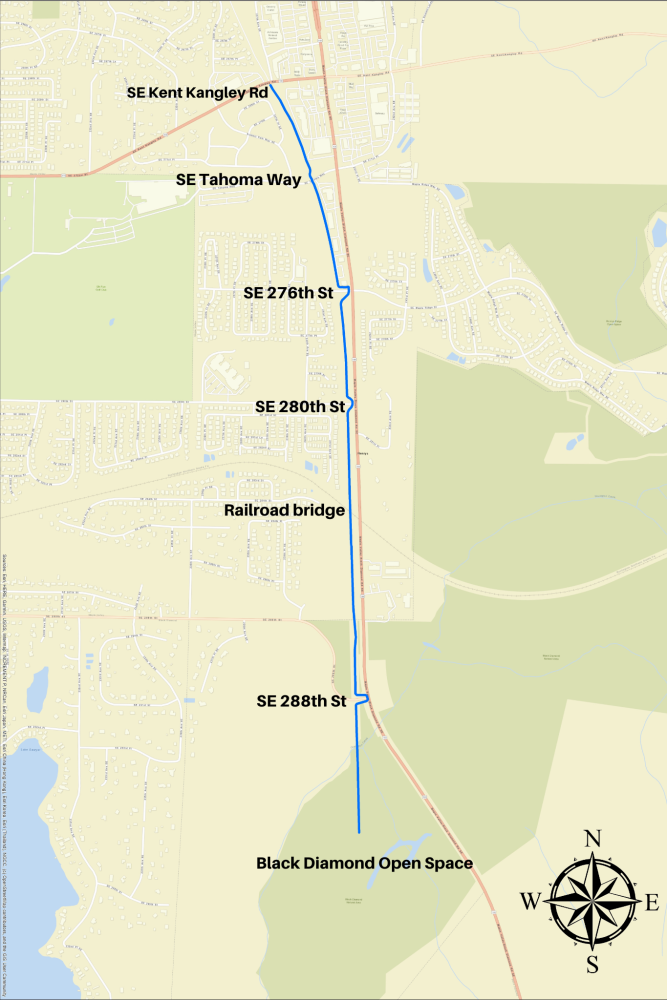
Map of proposed King County G2C Trail South Segment A showing intersections from SE Kent-Kangley Road to Black Diamond Open Space
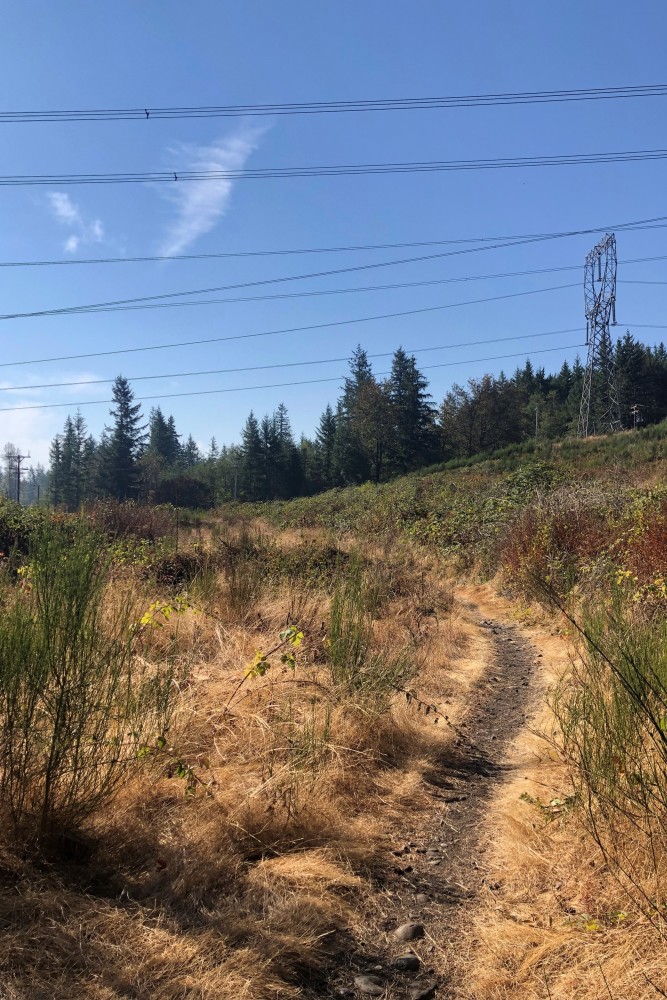
Example of trail conditions under the power lines
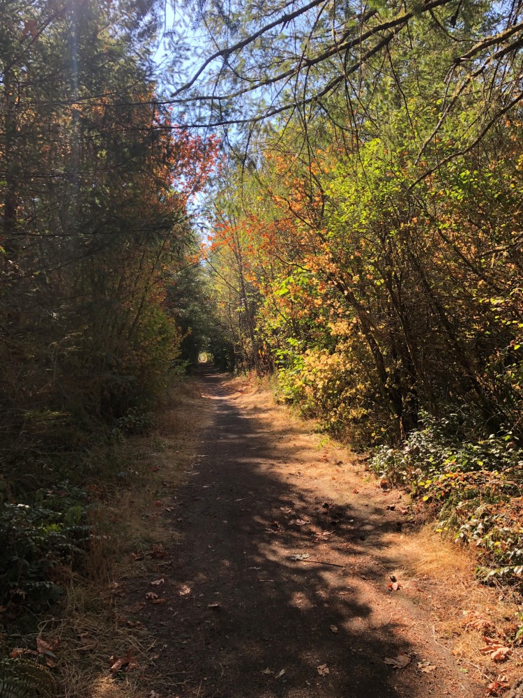
Example of current trail conditions south of the railroad
This is hidden text that lets us know when google translate runs.