Piney Plains Rd Survey
Piney Plains Rd Survey
Take this 5-minute survey, and help Cary plan for the future. As Piney Plains Road continues to develop, it provides an opportunity to evaluate the existing transportation network. Originally developed with single family homes, the development patterns will continue to reshape the area. The Piney Plains corridor, from SE Cary Pkwy to Dillard Drive, currently transitions from an existing 3-lane to 5-lane street as it continues north.
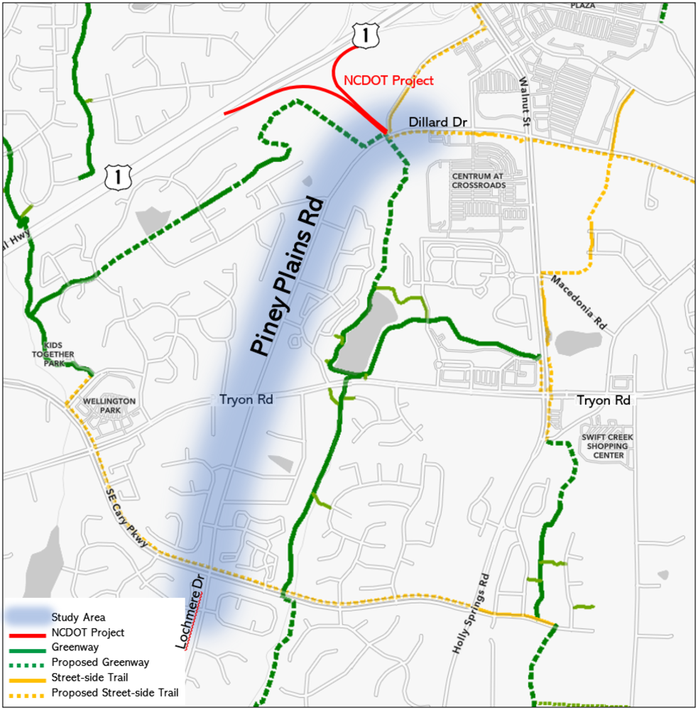
Study Area Map (click map to enlarge)
The Town of Cary is exploring ways to right-size and improve Piney Plains Road; this includes assessing the number of travel lanes, bike facilities, pedestrian facilities, access management and aesthetics. Please fill out the survey below to share your thoughts.
Go to www.townofcary.org/piney for more information on Cary's study. If you choose to participate – and we hope you do – please note that responses are considered public record under North Carolina law. Survey closes on March 15, 2021.
NCDOT Project: Links to NCDOT's project are provided at the bottom of the survey.
Learn more about NCDOT's project near Piney Plains Road. Information on NCDOT's project plans and status can be found on their website. Plans to improve the highway to highway interchange where I-40/I-440/US1/US64 intersect are underway. There is significant weaving (aka lane changes) as motorists approach and traverse this interchange which result in a high number of side-swipe accidents.
As part of the project, NCDOT will relocate the US 1 / Walnut Street ramps to Dillard Drive, shown in red on the project map. The proposed ramp relocation will improve safety on the highway, but impact traffic patterns on the local streets. NCDOT is assessing the impact to local streets as part of the project.

Continue sharing your voice. Go to Cary's Transportation Public Engagement Page to search for more outreach opprotunities.